This fantastic map from the Dublin City Council Digital Archive (minutely zoomable version available to download here) shows the junction of Inns Quay and Arran Quay in 1790, not long before the opening of the Four Courts on the old Inns of Court site close by.


The bridge appearing on the map is the Old Bridge of Dublin, replaced in 1818 by today’s Father Mathew (formerly Whitworth) Bridge. But what are those clusters of buildings on either side?
According to Liffey historian John de Courcy Ireland, the carriageway of the Old Bridge, built high at the centre to accommodate a navigation arch, reached the river walls on each side at a level significantly higher than quay level. As a consequence, its links to Arran Quay and Inns Quay on the north bank, and their links to one another, could not be on the edge of the river, but rather some 20m back, leaving space for riverside properties to develop in front. You can see a visual representation of these properties in the below extract from the engraving ‘A Perspective View of the City of Dublin from Phoenix Park,’ published in Middleton’s Complete System of Geography (1778). Thank you to tweeter @heliolight for being kind enough to provide this marvellous image.

The group of buildings on the western side of the Old Bridge were known as Arran Lane and were directly in front of 1-8 Arran Quay . Arran Quay was a fashionable gentry quarter back in the day but 1-8 were regarded as inferior to the other houses on the quay since, due to Arran Lane, they lacked a river view.
The notation on the 1790 map indicates that the buildings on the Inns Quay riverside were Derham’s Hotel, which may simply be a later incarnation of the chapel and hostelry historically recorded as located beside the Bridge.
You can see the riverside buildings, in much the same configuration, on Roque’s map below of 1756 but they are gone by the time of Jeffrey’s map of 1809. Nor do they feature in early visual representations of the Four Courts c.1800. It appears that they were demolished not long after the 1790 map which may indeed have been prepared for the purposes of their compulsory acquisition. The north quay was subsequently built up to meet the bridge deck.


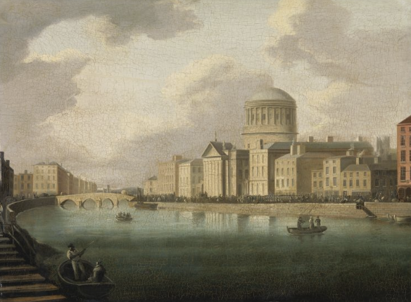
1-8 Arran Quay survived with their views and possibly also their values infinitely improved by the removal of Arran Lane. Below are some images of the Arran Quay-Inns Quay junction from the late 19th century up to the present day, including one unexpectedly glamorous representation. The Old Bridge of Dublin’s replacement, the Fr Mathew Bridge, has never looked better than when Rock Hudson travels over it hidden in the back of a cart at 14.23 of this YouTube version of the 1955 movie ‘Captain Lightfoot.’
Maps have their limitations in terms of visual depiction and it is wonderful that the 1778 image above (which may in fact be a copy of a 1753 view by Joseph Tudor) survives to give us an idea of what the junction of Inns Quay and Arran Quay looked like almost half a century prior to the opening of the Four Courts!


One thought on “As It Was: Images of the Inns Quay/Arran Quay Junction, 1753-present”